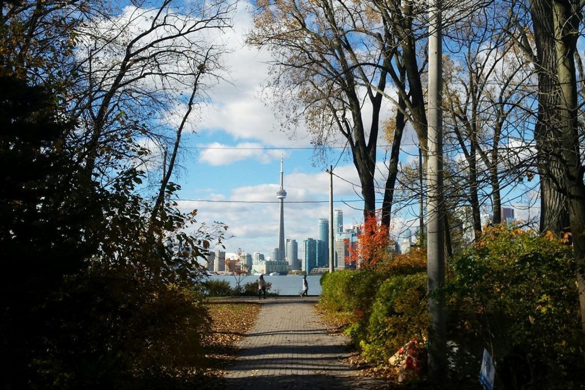
Construction is well underway on Toronto's Port Lands Flood Protection Project, which has been hailed as "one of the largest waterfront revitalization projects in the world".
On Friday, new details of the waterfront infrastructure development -- also known as the Don Mouth Naturalization project -- were released, painting a clearer picture of what the $1.25 billion project will entail.
Waterfront Toronto is now three years into the seven-year project that will re-naturalize the mouth of the Don River and create a new river valley through the Port Lands. When this project is complete, Toronto will have a new island, new parks and green spaces, and new roads and bridges -- the foundation for future communities just minutes from downtown.
READ: Toronto’s New 350-Tonne Cherry Street Bridge Has Officially Arrived (PHOTOS)
According to Waterfront Toronto, the Port Lands Flood Projection Project will help protect Toronto’s southeastern downtown area.
Right now, in an extreme weather event, floodwaters from the Don River would overwhelm portions of the Port Lands, South Riverdale, and Leslieville. The projection project will reconnect the Don River to Lake Ontario by creating a naturalized river mouth.
Along with other critical infrastructure to protect the area against flooding, this work will create the foundation for a future island community on the waterfront called Villiers Island — which is expected to be complete by 2024. Once developed, the island will provide homes to thousands of people and economic opportunities to thousands more.
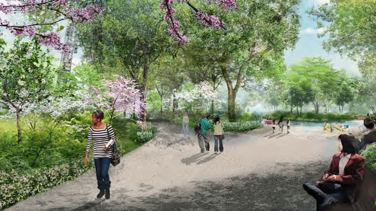
But also front and centre of the project is the creation of various parks and green spaces. During a recent public meeting new details were released about the new river valley and the parks that are being created.
A big takeaway from the meeting was the improvements made to the project's expansive public realm that will be located on Lake Shore Boulevard East.
This include modifications to the Lake Shore Bridge required for the Port Lands Flood Protection project as well as the reconstruction of Lake Shore Boulevard East as part of the City of Toronto’s Gardiner Expressway and Lake Shore Boulevard Reconfiguration (Gardiner East) project.
The designs show two sprawling parks, each with North and South counterparts, with shared features including gathering areas, public art, wayfinding and signange, site furnishings, lighting and materials, operations and maintenance, and plants.
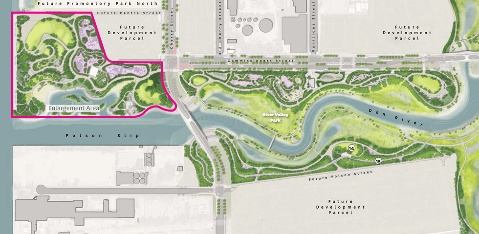
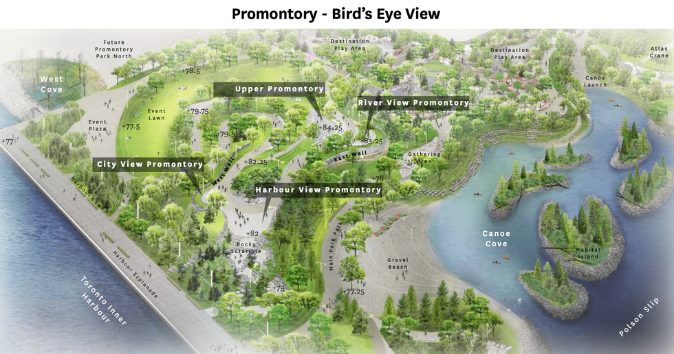
Promontory Park South will be located just west of Cherry Street and directly above the Polson Slip -- as seen above. When complete, this park will be home to an event lawn and plaza, a harbour esplanade, marine terminal, the atlas crane peninsula, an entry plaza, and a play area -- among other things.
River Park North will be located just south of Commissioner's Street, east of Cherry, and just north of the under-construction channel that will eventually serve as a naturalized mouth for the Don.
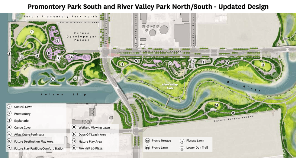
This park would feature an integrated network of paths, trails, and bike bridges that would connect a series of natural play areas and surfaces that includes the "Cableway Canyon," the "Green Giant Forest," and the "Badlands Scramble." There will also be picnic terraces and lawns, a fitness lawn, an eco-classroom, a wetland view lawn, and off-leash dog areas.
In addition to the much-needed parkland, the project also includes the recently delivered 57 metre, 350-tonne Cherry Street North bridge, which is the first of four new bridges that will connect the new Villiers Island to Toronto and to the revitalized Port Lands.
Waterfront Toronto CEO George Zegarac, said the bridges will be a connection for the public to access the new island that’s being built building and, above all, “connect us to Toronto’s future.”
You can learn more about the project's updates in the video below.