Calling all infrastructure enthusiasts: the first new bridge for the sprawling Port Lands development in Toronto officially arrived over the weekend, after embarking on a week-long journey via barge up the St. Lawrence Seaway from its manufacturing location in Nova Scotia.
On Saturday evening, the new Cherry Street North bridge arrived in Toronto’s Harbour, marking a milestone for the $1.25 billion Port Lands Flood Protection project -- which is being spearheaded by Waterfront Toronto.
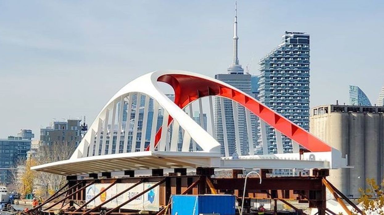
Over the past week, the barge carrying the bridge made its way up the St. Lawrence Seaway, before arriving in Toronto’s Harbour to be installed in the Port Lands. The-57 metre, 350-tonne bridge, is the first of four new bridges that will connect the new Villiers Island to Toronto, and the revitalized Port Lands.
READ: Toronto’s New Port Lands Bridges to Be Floated Up the St. Lawrence River
Waterfront Toronto CEO George Zegarac, says the bridges will be a connection for the public to access the new island that's being built building and, above all, "connect us to Toronto’s future."
"The bridges are another piece Waterfront Toronto is adding to make our city’s waterfront world class, just as bridges have helped define the image of cities like Chicago and Sydney,” said Zegarac.
Work has been continuing all year on the Port Lands project, including excavating the new path for the Don River and creating Villiers Island.
Beyond providing critical flood protection, Zegarac said this project is going to deliver a stunning new destination steps from downtown for people to live, work, and enjoy nature, as well as helping to drive Toronto’s economic recovery.
The barge's arrival was celebrated with an 'arrival party' hosted by Waterfront Toronto and attended by Minister of Infrastructure and Communities Catherine McKenna, Ontario Minister of Infrastructure Laurie Scott and City of Toronto Mayor John Tory, who spoke about the project reaching the new milestone.
“I look forward to the arrival of the first of the new Cherry Street bridges to Toronto’s inner harbour coming all the way from Nova Scotia," said Mayor John Tory.
"I know these new bridges will become an iconic part of our waterfront and a signature landmark in our already unique skyline. The Port Lands Flood Protection project is one of the largest waterfront revitalization projects in the world and one of the most ambitious and significant infrastructure projects in Toronto’s history. By working with other levels of government we are ensuring that this project moves forward and building up Toronto’s waterfront for generations to come.”
According to Waterfront Toronto, the Port Lands Flood Projection Project will help protect Toronto’s southeastern downtown area.
Right now, in an extreme weather event, floodwaters from the Don River would overwhelm portions of the Port Lands, South Riverdale, and Leslieville. The projection project will reconnect the Don River to Lake Ontario by creating a naturalized river mouth.
Along with other critical infrastructure to protect the area against flooding, this work will create the foundation for a future island community on the waterfront called Villiers Island -- which is expected to be complete by 2024. Once developed, the island will provide homes to thousands of people and economic opportunities to thousands more.
In case you missed the arrival of the bridge, Torontonians shared some incredible bridge photos on social media that you can enjoy below.